Satellite Data in Agriculture: How Smart Farming Technology Is Transforming Africa’s Future 2050.
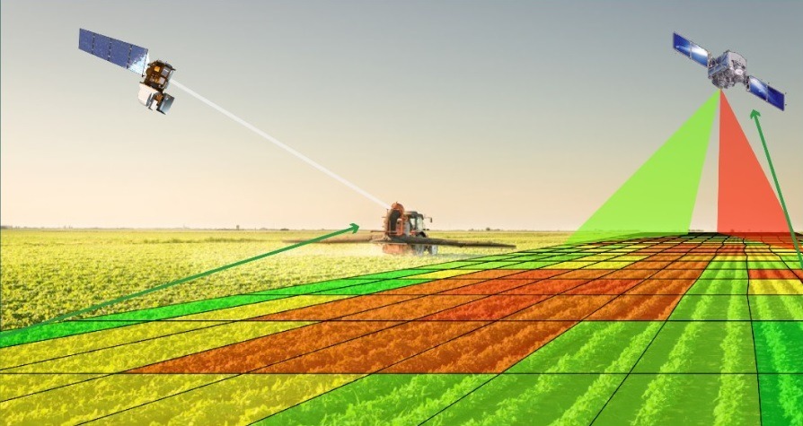
Table of Contents
Introduction
Satellite data in agriculture is changing how farmers grow food across the world. In Africa, satellite data in agriculture is helping farmers track crops, manage water, and reduce losses caused by climate change. With better information from space, farmers can make smarter decisions on time. This new smart farming technology is giving African agriculture a powerful boost and opening new opportunities for food security and growth.
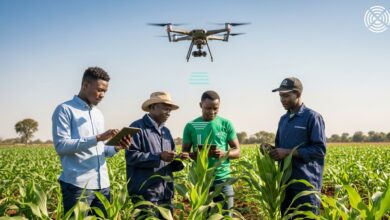
How Satellite in Agriculture Improves Crop Monitoring
Satellites in agriculture allows farmers to monitor crops without walking through every field. Using Earth observation images from space, farmers can see crop health, soil moisture levels, and early signs of disease. In countries like Kenya and South Africa, satellites in agriculture is already being used to detect drought stress before crops turn yellow.
This technology works by analyzing light reflected from crops. Healthy plants reflect light differently than stressed plants. With satellite data in agriculture, farmers receive alerts when something is wrong. This early warning system helps them act fast, apply fertilizer correctly, or improve irrigation. As a result, yields increase and waste decreases.
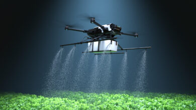
How Satellite Data in Agriculture Supports Water Management
Water is one of the biggest challenges facing African farmers. Satellites in agriculture helps farmers manage irrigation more efficiently. By measuring soil moisture from space, farmers know exactly when crops need water. This reduces overwatering and saves money.
In countries where rainfall is unpredictable, satellite data in agriculture provides real-time weather patterns and rainfall tracking. Farmers can plan planting seasons based on accurate data instead of guesswork. For example, in parts of West Africa, farmers now use satellite-based weather forecasts to decide the best planting dates. This simple change can increase harvest success by 10% to 20% in some regions.
Better water management through satellites in agriculture also protects rivers and groundwater from overuse, supporting long-term sustainability.
𝐀𝐥𝐬𝐨 𝐑𝐞𝐚𝐝 : https://www.datadriveharvest.com/2026/02/24/ai-in-agriculture-africa/
Reducing Risk with Satellite Data in Agriculture
Climate change has made farming more risky than ever. Floods, droughts, and heatwaves damage crops and reduce incomes. Satellite data in agriculture helps reduce these risks by providing early warning systems.
Governments and agritech companies across Africa use satellite data in agriculture to track extreme weather events. When drought conditions are detected early, farmers can switch to drought-resistant crops or adjust irrigation schedules. When heavy rainfall is predicted, farmers can harvest early to avoid losses.
Insurance companies are also using satellite data in agriculture to assess crop damage quickly. This allows faster compensation payments to farmers after disasters. By lowering financial risk, satellite data in agriculture makes farming more secure and attractive for investment.
𝐉𝐨𝐢𝐧 𝐎𝐮𝐫 𝐖𝐡𝐚𝐭𝐬𝐀𝐩𝐩 𝐆𝐫𝐨𝐮𝐩 𝐟𝐨𝐫 𝐦𝐨𝐫𝐞 𝐔𝐩𝐝𝐚𝐭𝐞𝐬 : https://chat.whatsapp.com/HT6ebp6IWfcKsT9nwXhkXn?mode=hqrt2
Boosting Productivity with Satellite Data in Agriculture
One of the biggest benefits of satellite helps in agriculture is higher productivity. With accurate field maps and crop analysis, farmers can apply fertilizer only where needed. This precision farming approach reduces costs and increases efficiency.
In Ethiopia and Nigeria, digital agriculture platforms combine satellite data in agriculture with mobile apps. Farmers receive simple messages on their phones telling them when to plant or fertilize. Even smallholder farmers with limited resources can now access advanced insights.
Studies show that precision farming methods supported by satellite data in agriculture can increase yields by up to 15% while lowering input costs. For African farmers, this means more income and stronger food security.
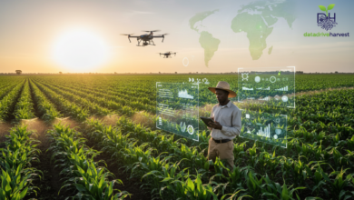
The Future of Satellite Data in Agriculture in Africa
The future of satellite views in agriculture looks promising for Africa. With improved internet access and mobile technology, more farmers can benefit from digital tools. Governments are also investing in space programs and partnerships with global Earth observation agencies.
Satellite in agriculture can support national food security strategies and help Africa meet its growing food demand. By 2050, Africa’s population is expected to double. Smart farming solutions powered by satellite data in agriculture will be essential to feed millions of people.
As technology becomes cheaper and more accessible, satellites in agriculture will move from large commercial farms to smallholder farmers across rural communities. Training programs and digital literacy initiatives will play a key role in scaling adoption.
Conclusion
Satellite in agriculture helps to transforming farming across Africa. From crop monitoring and water management to risk reduction and productivity growth, satellites in agriculture gives farmers the tools they need to succeed in a changing climate. By providing accurate, real-time information from space, this technology reduces waste, increases yields, and strengthens food security.
As Africa continues to embrace digital agriculture, satellite data in agriculture will become a central pillar of sustainable farming. The opportunity is clear: smarter farming powered by satellite data in agriculture can drive economic growth, improve livelihoods, and secure the continent’s agricultural future.